WiMap is a tool to convert your NetStumbler logs into the "latlon" or "draw object" file format recognized by certain versions of Delorme Street Atlas, and/or into the "PCX5" format that Garmin's MapSource system will import.
In the transition from the "Street Atlas N" versions (e.g. Street Atlas 7) to the "Street Atlas 200x" versions (e.g. Street Atlas 2003), Delorme apparently revamped the drawing system such that the original functionality of WiMap was almost entirely broken. Street Atlas 2005 restores some ability to control the presentation of imported objects; accordingly, WiMap 0.7 was released to take advantage of this event.
WiMap 0.8 was subsequently released to provide Garmin MapSource export capabilities.
WiMap 0.8.1, 15-Nov-2004, a bugfix release, is here
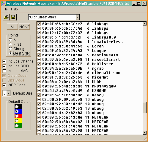
You first use the "export" function of NetStumbler to create a "wi-scan with extensions" text file (File|Export|Text). Then you open that file using WiMap:
When you have selected the options you want, perform a "save" operation, then use the "File|Import Lat/Lon" menu selection in Street Atlas. If you also import the track data from your GPS, you might see something like this (assuming you are using an older version of Street Atlas and selected the "Old" Street Atlas output format):
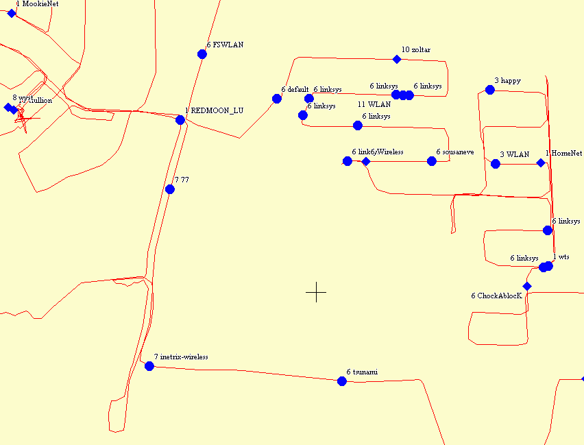
Note: map details have been suppressed to avoid copyright issues. The street details in this particular area were horrendously inaccurate in any event, so not much is lost by turning them off.
In this example, networks with WEP in use appear as diamonds, and other networks appear as circles.
If you are using Street Atlas 2005 and have selected the "New" Street Atlas option, use the "File Import" function on the "Draw" tab to import the file you created. If you have selected the WEP Code option you should see WEP networks represented by a red 'X', and non-WEP networks represented by a map pin. Recent editions of Street Atlas no longer make it possible to control size and color attributes, so the signal strength color and size encoding features are not available. Here's what it looks like:

Note: map details have been suppressed as above. Three or four years have elapsed, and the accuracy in this particular area is still wretched.
Someday there will be real help files and documentation for this item; at the moment, however, it is sufficiently uncomplicated that just about everything can be discovered by a few minutes of experimentation.
Expressions of praise, rage, anguish and other typical reactions may be directed to the author at the account wimapcontact hosted at the domain honet.com. The earlier contact address, wimap@honet.com, became such a spam magnet that I had to retire it.
Last update: 17-Sep-2007 15:29